Description
Locate and Map Underground Utilities with GSSI Dual-frequency digital GPR system
UtilityScan DF incorporates our innovative dual-frequency digital antenna (300 and 800 MHz) and an easy-to-use touchscreen interface with patented Blend Mode technology to view shallow and deep targets simultaneously in a single scan.
| Max Depth | 7 m (21 ft) |
| Antenna Frequency | 300/800 MHz |
| Weight | 51-66 lbs (cart dependent) |
| Storage Capacity | 128 GB |
| Optional Software | RADAN 7 for UtilityScan, RADAN 7 |
| Accessories | Sunshade for Panasonic G1, LineTrac |
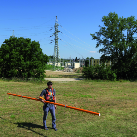
Target Designation
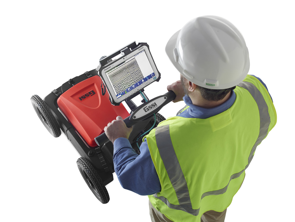
The UtilityScan DF features real-time data collection. This portable GPR unit has a backup cursor and cross-hair cursor that allows the user to confidently mark targets.
Typical Uses
The UtilityScan DF is typically used for:
- Utility detection
- Environmental assessment
- Damage prevention
- Geological investigation
- Archaeology
- Forensics
- Road inspection
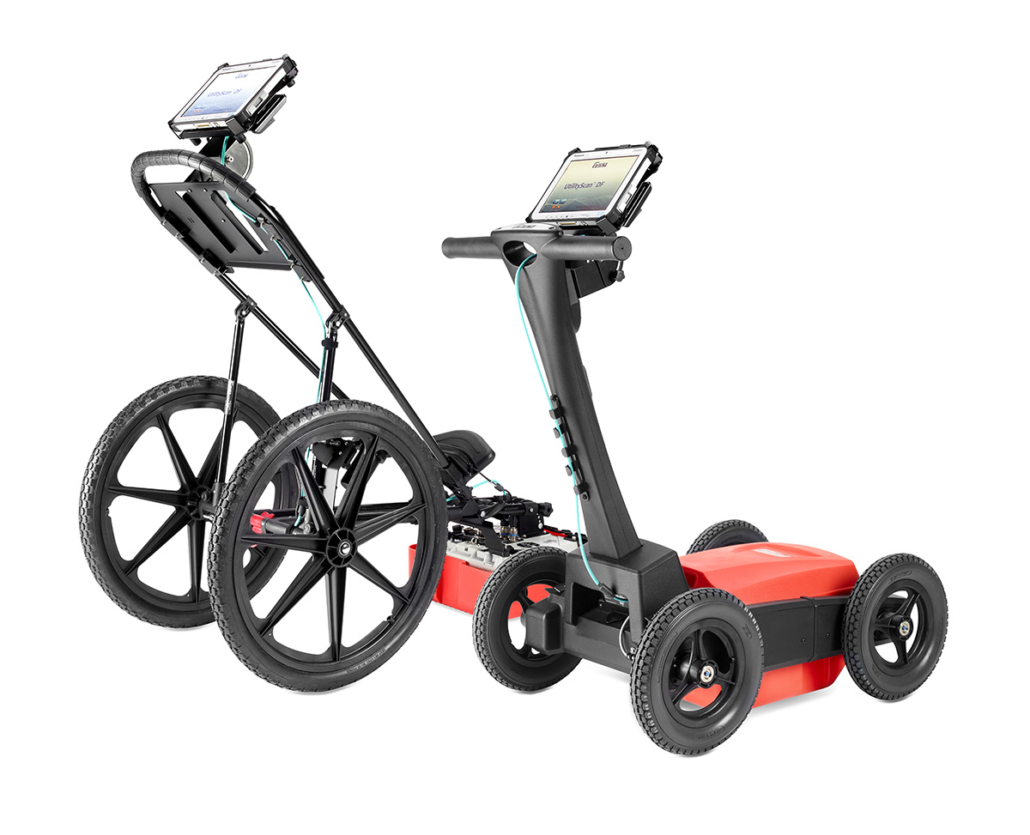
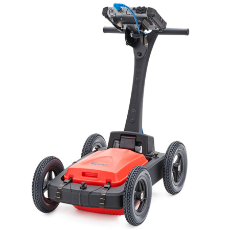
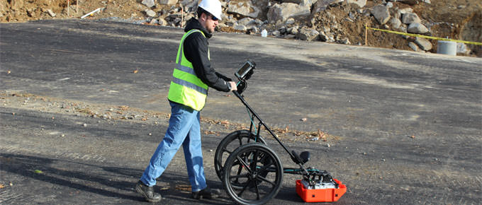
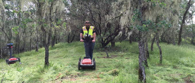
Premium Mobility
UtilityScan DF has two different cart options to enhance ease of use on all job sites. The four-wheel rugged cart is built to withstand the toughest job sites, while the two-wheel cart is lightweight and easy to transport.
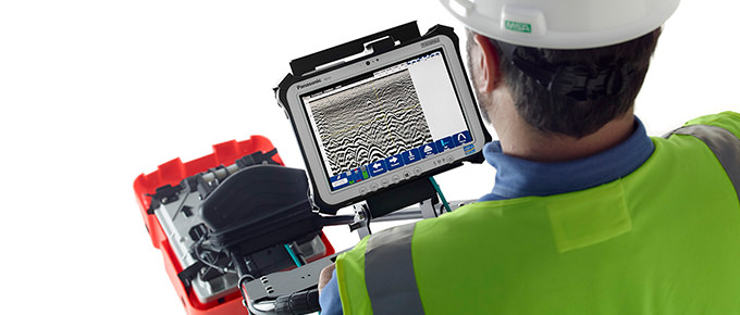
Enhanced Software Capabilities
There are several modes to view collected data. Our patented blend mode combines high resolution near-surface data with lower depth details into one ‘blended’ data set.
Data Examples
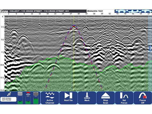
Blend Mode
Data illustrates several metallic and non-metallic targets at various depths in the blend mode. Green shaded area represents estimated signal floor. Red/Blue dotted line identifies the soil velocity calculation tool.
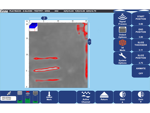
3D Mode
Data illustrates metallic targets at depths of 1,2 and 3 feet collected at GSSI’s utility test pit using 3D Mode