Description
GEM Systems is the global leader in the manufacture and sale of high precision magnetometers and is the only commercial manufacturer of Overhauser magnetometers and Gradiometers that are accepted and used at Magnetic Observatories over the world.
GEM Systems GSM-19 Overhauser total field magnetometer and the GSM-19G Gradiometer provide improved data quality and greater absolute accuracy than Proton magnetometers, while providing a robust and comparable system to costlier Cs magnetometers for ground applications.
GEM’s Overhauser Magnetometer system is a revolutionary geophysical instrument developed by GEM to offer a rugged, low power, and sensitive alternative to Proton Precession and some other alkali vapour magnetometers.
GEM’s GSM-19 (Overhauser) magnetometer is a primary standard in mineral exploration and magnetic observatories. As a standard for magnetic observatories, this system has proven itself – for its high sensitivity, absolute accuracy and long life. Overhauser magnetometers are also used in archaeology, pipeline mapping, UXO detection, and other engineering and environmental applications.
Benefits
The GSM-19 is our mid-range instrument with excellent benefits for subsurface exploration. The Overhauser system offers an order-of-magnitude increase in sensitivity over GEM’s Proton system and matching sensitivities of some alkali devices. With data quality exceeding the standard proton precession, and comparable to the costlier optically pumped caesium magnetometer systems, the GSM-19 is a standard for many applications.
Overhauser magnetometers also provide high absolute accuracy, ruggedness, and reliability – as numerous systems are in operation around the world with an excellent performance record so that the GSM-19 can be counted on in any situation. Early versions of the Overhauser, developed in 1983, are still running on a continuous basis at an observatory in Japan.
Overhauser offers the option of pulsed versus continuous operation. With pulsed operation, the system provides an energising pulse to initiate the reading. With continuous operation, the system is always active – so that data can be recorded conveniently anywhere, at any time.
GEM’s Overhauser magnetometer/gradiometer also offers much less power consumption than Proton or alkali vapour systems so you can perform a whole day’s work on a single charge. Optional benefits include an omni-directional sensor (i.e. no dead zones) and fast sampling. Fast sampling of up to 5 Hz is available – an important capability for many larger surveys. This fast sampling gives the option to automate readings on a vehicle such as an all-terrain-vehicle (ATV), snowmobile sled, etc.
The Overhauser Magnetometer does not require maintenance – it is as robust and effective an instrument as ever made for the field. It also has superior environmental specifications, which include an operating temperature of -40°C to +50°C; giving unparalleled performance throughout all survey conditions.
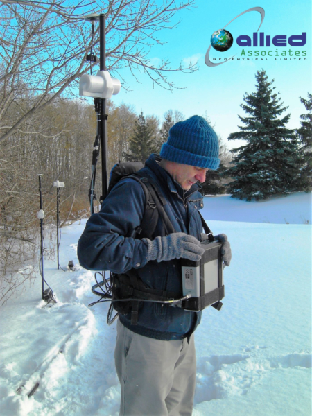
The cables and connectors have been carefully selected for maximum durability and performance. The light weight backpack gives hands-free operation while ensuring a stable, comfortable, and lightweight platform for making measurements.
Integrated GPS
Not only do our GPS technologies tell you where you have been, but they tell you where you need to go. This allows for highly accurate readings via ‘Waypoint Programming’ as well as accurate time synchronisation for base station corrections.
With Waypoints, you design your survey on your personal computer and import the stations with ease into the magnetometer console. Then, the system will guide you to each Waypoint where a reading is to be made. With ‘Walking’ mode, you have a nearly continuous record of GPS-referenced data points – a major advantage in surveying because you save time in the field and it eliminates the possibility of positioning mistakes.
SPECS
Sensitivity: 0.022 nT @ 1 Hz, (0.015 nT option)
Resolution: 0.01 nT
Absolute Accuracy: +/- 0.1 nT
Dynamic Range: 20,000 to 120,000 nT
Gradient Tolerance: Over 10,000 nT/m
Sampling Intervals: 60+, 5, 3, 2, 1, 0.5, 0.2 sec
Operating Temperature: -40°C to +50°C
Operating Modes
Manual: Coordinates, time, date and reading stored automatically at upto 0.2 sec.
Base Station: Time, date and reading stored at 1 to 60 second intervals.
Remote Control: Optional remote control using RS-232 interface.
Input/Output: RS-232 using 6-pin weatherproof connector with USB adapter.
Memory – (# of Readings in millions)
Mobile: 1.4M, Base Station: 5.3M,
Gradiometer: 1.2M, Walking Mag: 2.6M
Dimensions
Console: 223mm x 69mm x 240 mm (8.7×2.7×9.5in)
Sensor: 175mm x 75mm diameter cylinder (6.8in long by 3 in diameter)
Weights
Console with Belt: 2.1 kg
Sensor and Staff Assembly: 1.0 kg
Standard Components
GSM-19 console, GEMLink software,battery, harness, charger, sensor with cable, RS-232 cable and USB adapter, staff, instruction manual, and shipping case
Options
Gradient Magnetometer, Walking Mode, Multi sensor
Accessories
Available GPS
GPS Time Only (Option A)
Standard GPS (Option B):
• 0.7m SBAS (WAAS, EGNOS, MSAS)
• < 1.5m non-SBAS
Enhanced GPS (Option C):
• 0.6m SBAS (WAAS, EGNOS, MSAS),
GLONASS, BeiDou, Galileo
• Consult GEM for availability
High resolution GPS (Option D):
• 0.6m SBAS (WAAS, EGNOS, MSAS),
GLONASS, BeiDou, Galileo
• 40 cm or 4cm accuracy with NovaTel Correct
(TerraStar Subscription required)
• Consult GEM for availability
VLF Option :
Frequency Range: 15 to 30.0 kHz with
up to 3 stations. Parameters: Vertical in-phase and
out-of-phase components as % of total field.
Add VLF-EM for a complete cost effective multi-parameter survey solution to provide resistivity sections. Please see the VLF brochure
Resources
GEM GSM-19 Overhauser Brochure
NEW GEMLink 5.4 Software for PC
GEMLink is a Windows based application used for all GEM Systems’ magnetometers / gradiometers.
GEMLink features include:
- Magnetic Data Downloading with buffer indication (Text or Binary)
- On-screen Editor
- Profile Plotting
- Diurnal Correction
- File Merging
- Coordinate Conversion
- Conversion to a different datum
- Upload Way Points
- Programmable Base Schedule Upload
- Software Upgrade
- Basic Modeling utilities
- Multiple channel Real-time Magnetic Graph
- Basic magnetic map plotting and contour
- Stack (Mirror) data plotting for VLF diagnostic.
- Supports Multi-language Windows
- Updated UK/US World Magnetic Model 2010
- USB serial adapter disconnection protection
- Real time graph for Mag or Grad Value
- Waypoint Plan Function
- Waypoint Tracking Function
To download the latest version of GEMLink, Click here.

